Features
Everything your visitors can do.
Watch the course, explore it, read it, share it, and put your sponsors on it. Every feature here is in every plan.
01 · Watch
A course preview that plays like a film.
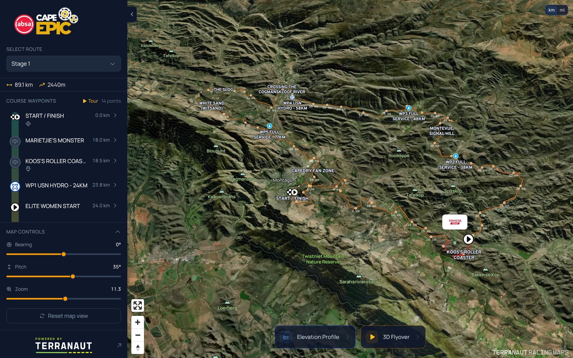
Visitors do not have to work the map to understand the race. Press play and the course tells itself.
- Cinematic 3D flyover
- A runner dot flies the route and paints it in your race colour. The camera directs itself from the shape of the course: riding behind the runner, sweeping alongside, pulling back over twisting ground, circling the summits and swinging round for the finish. It checks the terrain so it never ends up inside a hillside.
- Speed and view controls
- Pause, resume or stop at any point. Choose 1×, 2.5× or a high, wide helicopter view. The elevation profile follows the flyover as it goes.
- Guided tour
- Your course highlights in the order you choose, each with its own 3D camera angle. Step through it stop by stop to present the course at a route launch, or press autoplay and it loops on its own on a race village screen. It runs in a laptop or desktop browser.
- Broadcast mode
- A full-screen flyover for a hosted moment on stage or at registration. Someone at the laptop steers the camera, switches between camera angles as it plays, and can hide labels and markers for a cleaner picture.
- Auto-rotate on load
- Switch it on in the embed settings and the map turns slowly when the page opens, until a visitor takes control.
02 · Explore
Detail for the athletes who study every metre.
The map answers the questions athletes ask before race day, on the terrain they will actually ride or run.
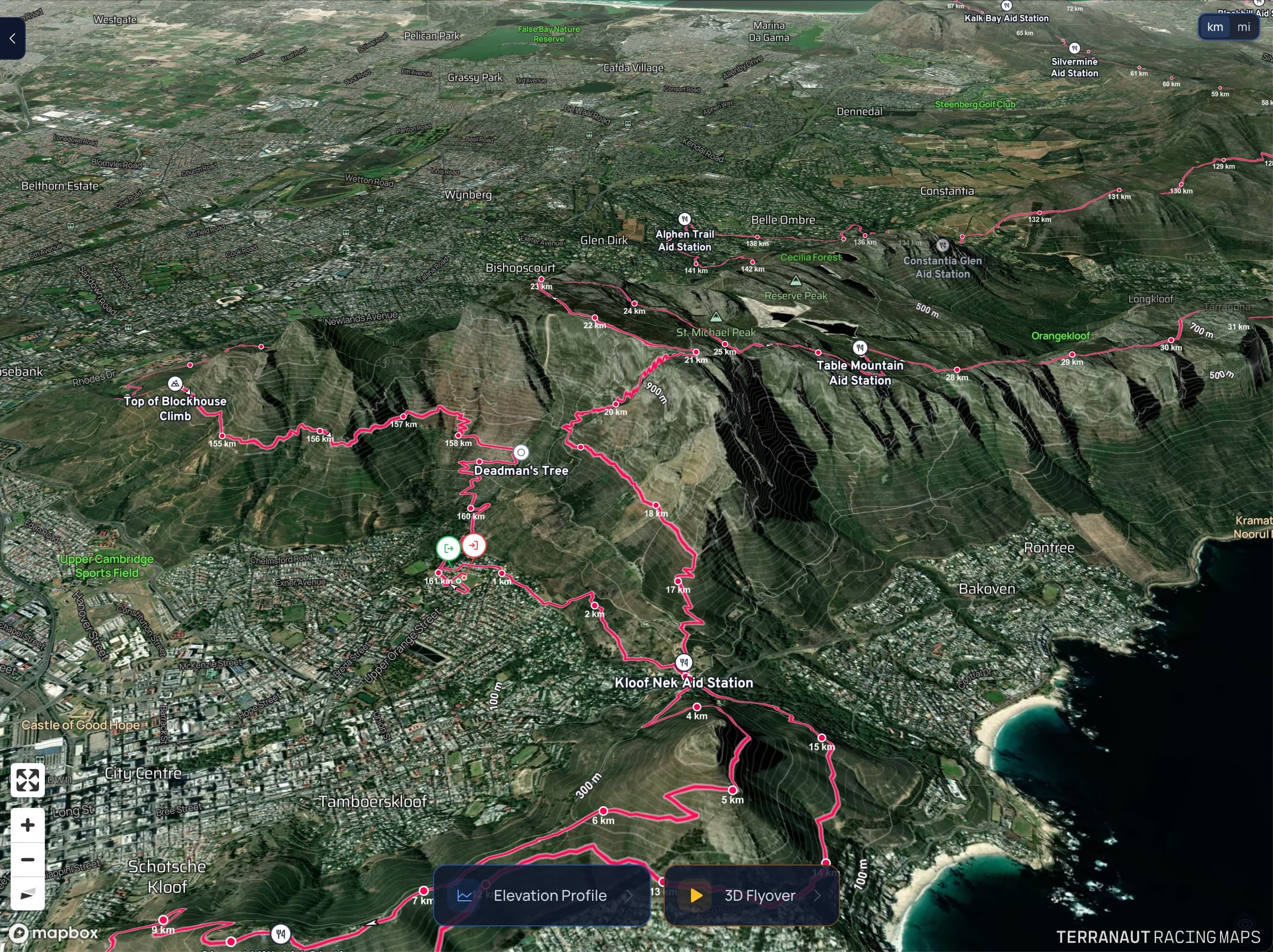
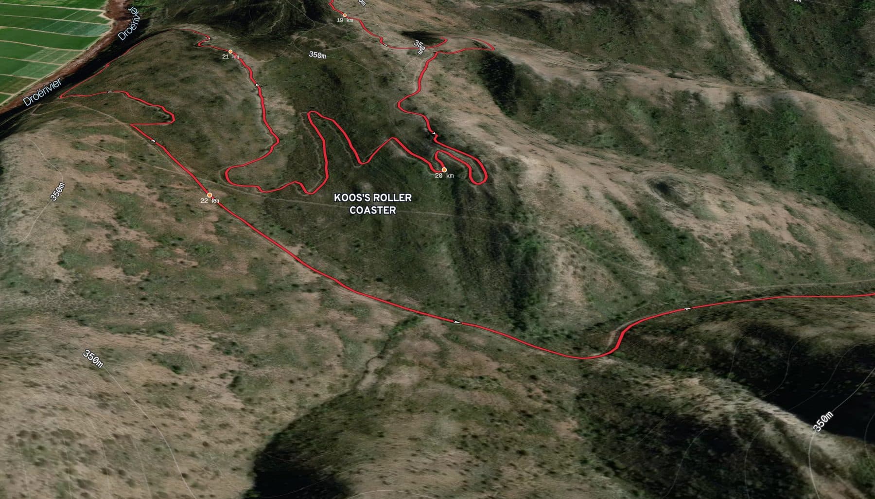
- 3D satellite terrain
- Satellite imagery over real 3D terrain, with contour lines, place names, distance markers and direction arrows along the route. Bring your own Mapbox style on a multi-event plan.
- Rich waypoints
- Start, finish, water, food and drink, toilets, spectator points, shuttles, registration, parking and your own custom types, each with its own icon.
- Waypoint cards
- Each stop opens into a card with its distance and ascent, coordinates, cut-off time, on-site amenities such as medical, drop bags and crew access, notes, a photo or a video, and a location map.
- Interactive elevation profile
- Run a finger or mouse along the profile and a dot shows that exact spot on the map. Tap any point and the camera flies there. Waypoints and sponsored segments sit on the line, with distance, ascent and descent above it.
- Every route in one map
- Full, half and 10K, or each stage of a stage race. Visitors switch routes without leaving the page, and each route has its own link.
- The small things
- Kilometres or miles at a tap. Bearing, pitch and zoom controls. A GPX download wherever you allow it.
03 · Read
Words written from the course itself.
Most route descriptions are written once and never updated. Ours start from the real course data.
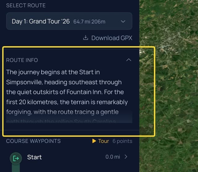
- AI route descriptions
- Generate a description from the route's geometry, elevation, waypoints and the places it passes. Add your own guidance, edit the result, then publish. It appears beside the map and in the route brief on phones.
- AI first drafts for the rest
- Draft an event overview, a marketing blurb and participant briefings from the same data. Edit them in your own voice before you use them.
- Smart waypoint import
- Upload a route file with waypoints in it and we sort them into types for you, ready to check and publish.
04 · Share
On your website, on every screen.
The map lives on your own course page. Visitors stay on your site, under your brand.
- One iframe
- Copy the embed code and paste it wherever your website accepts HTML. Change the map any time and the page updates.
- Made for phones
- A layout of its own on mobile, with Stops, Elevation and Flyover tabs and a route picker at the top.
- Links that look good
- Share a route link and it unfurls with a preview card showing the course's elevation outline.
- Your event, your look
- Your logo above the course, your route colours on the line, and your own opening camera angle.
05 · Measure
See who came, and what they did.
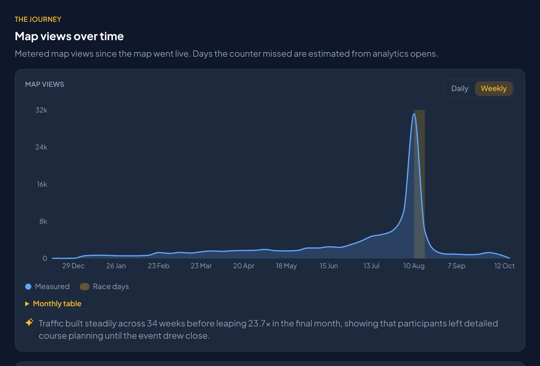
Every event gets an Analytics tab built from real visits to your map.
- View counters
- Map views for the last 7 days, this month and all time, on your event dashboard.
- The Analytics tab
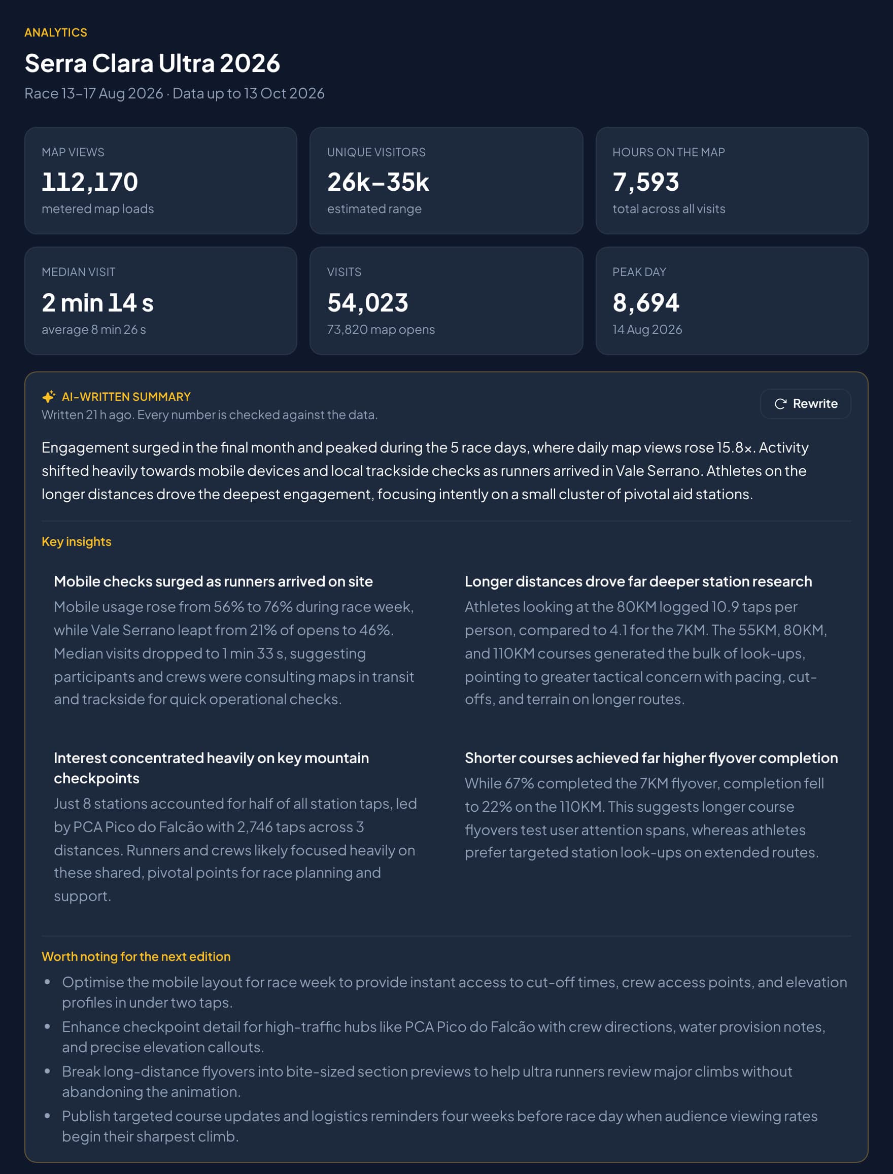
- Map views, unique visitors, hours on the map, the median visit and the peak day. Race week hour by hour, time of day, regions, countries and devices.
- What people did
- How many visitors interacted, tapped a station, started or finished the flyover, opened the elevation profile or switched distance, and which stations were opened most.
- An AI summary
- An optional written summary of the numbers, with insights and ideas for the next edition. Every figure in it is checked against the data.
06 · Sponsor
A media surface your sponsors can own.
Interactive sponsor markers that open into a YouTube video and a call to action. Sponsored segments on the route and the elevation profile. Sponsor stops in the guided tour.
Try it on a real race.
Open the Absa Cape Epic map and press 3D Flyover. Then build one for your own course. Free to build, pay when you publish.